SustaiN
A Decision Support System for Sustainable Nitrogen Management in Corn and Sorghum using Remote Sensing.
Jan 9, 2023
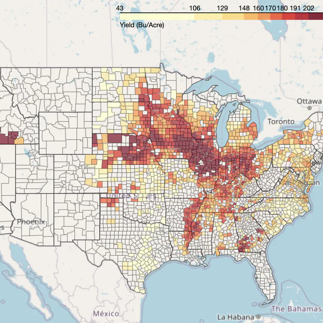
AgLapse
A spatiotemporal visualization tool for four major agricultural crops in the United States.
Sep 16, 2022

MapLapse
A python library to create animated timelapse of maps.
Aug 28, 2022
Raster4ML
A geospatial raster processing library for machine learning.
Jul 11, 2022