A Decision Support System for Sustainable Nitrogen Management in Corn and Sorghum using Remote Sensing.
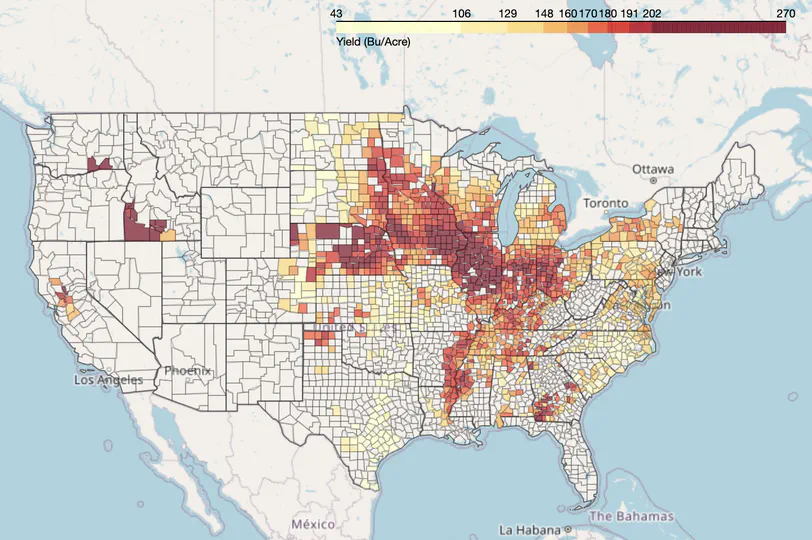
A spatiotemporal visualization tool for four major agricultural crops in the United States.
A python library to create animated timelapse of maps.
A geospatial raster processing library for machine learning.